Your group. One map.
One live map for your whole group: where everyone is, what they said, and where you're going. It runs over the internet in town and over LoRa radio when the signal drops, then syncs when you're back. Free on iPhone, iPad, Android, desktop and the web.
Everything your group needs.
Live locations, chat, pins, routes, zones and weather in one focused app, online or over radio. Here is all of it, on the real app.
See your whole group move.
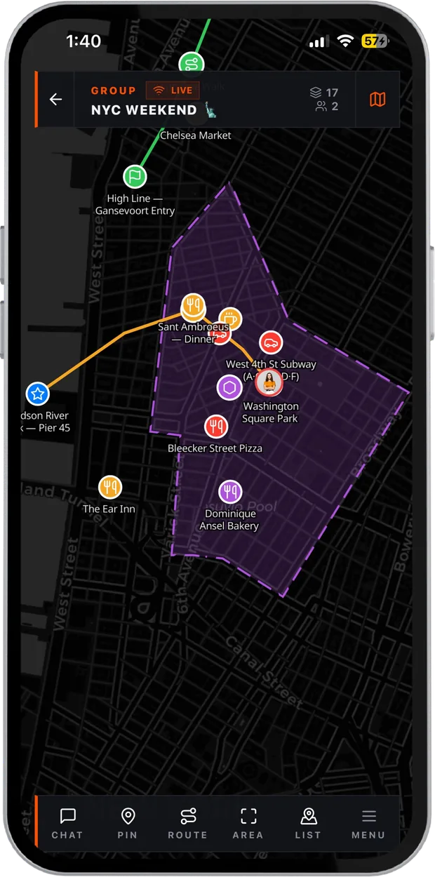
No more "where are you?" Everyone in the group appears on one shared map the moment they join, and moves live. No refresh, no pinging, no guessing.
- Live trackingEvery member in real time, with their heading and when they were last seen.
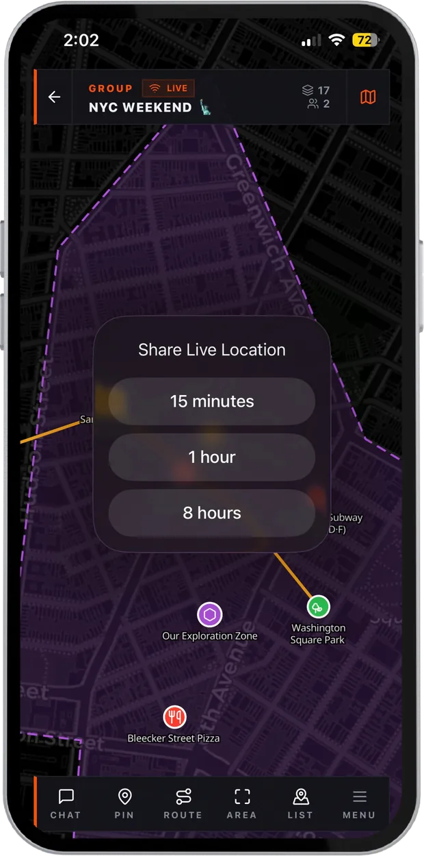
- Live ShareBroadcast your position for 15 minutes, an hour or up to 8 hours, even with the phone locked.
- Compass and headingA live bearing display, so you know which way to walk, not just where.
- One-tap navigateHand any pin to Apple Maps or Google Maps for turn-by-turn directions.
- Place searchJump to any city, address or landmark.
Mark the plan on the map.
Drop the meeting point, draw the route, shade the search sector. Everything you add is shared with the group instantly, with photos, voice notes and a comment thread on each one.
- PinsName, describe and place them by tap or by coordinates.
- RoutesTrace any path with a finger, or record the one you walk.
- AreasShade zones, grids and sectors.
- Photos and voice notesAttach them to any pin, route or area.
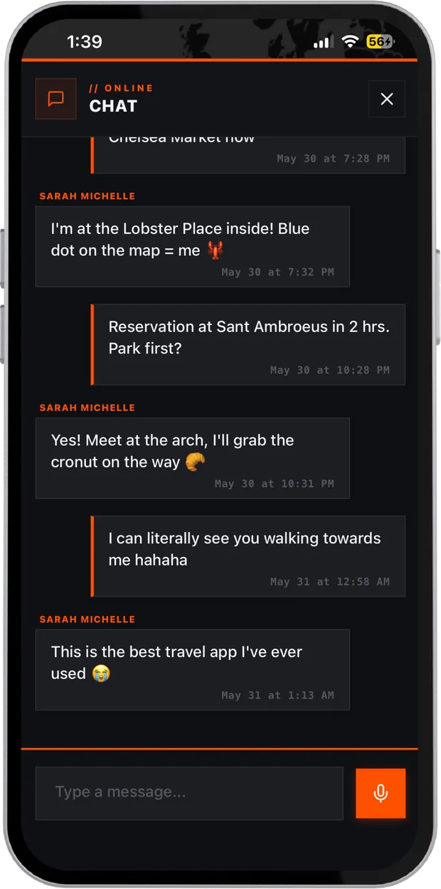
- One list for everythingMembers, pins, routes and areas, searchable and filtered.
Talk without leaving the map.
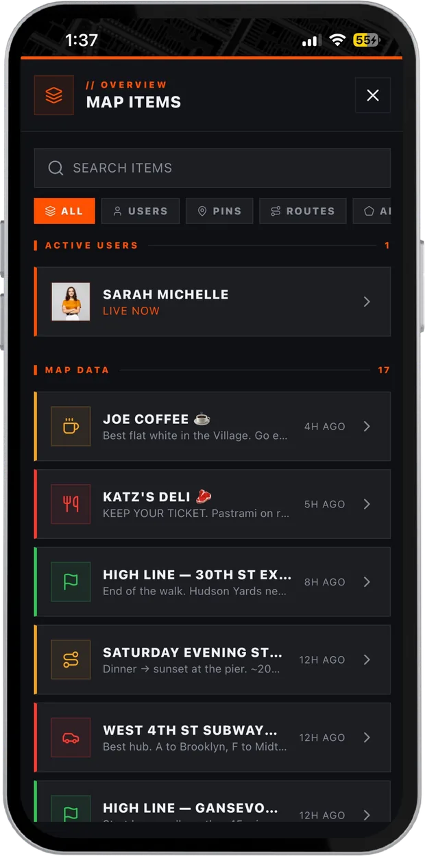
The group chat sits over the live view, so the conversation and the map never compete. Tap a location in a message and the map flies straight to it. Text even works over mesh radio.
- Voice notesHold to record, send to the group.
- Photos in chatShare what you see, where you see it.
- Comments on anythingDiscuss a pin, a route or an area right where it sits.
- Delivery statusOver radio, every message shows pending, sent or failed.
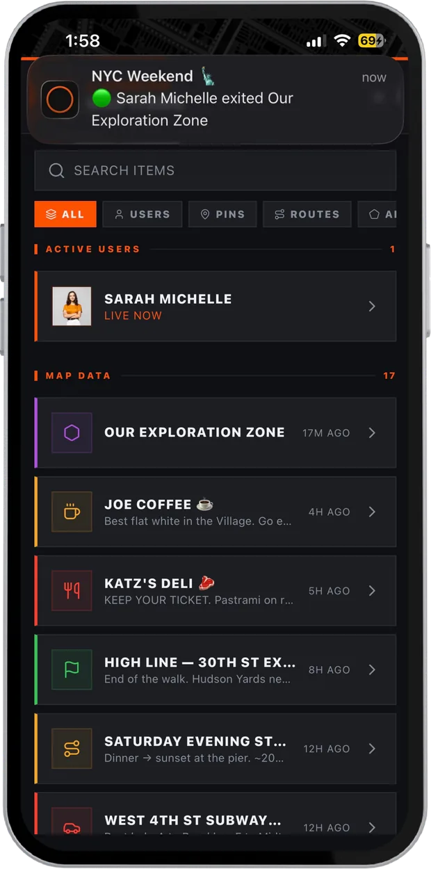
Know when someone crosses the line.
Draw a zone around camp, the venue or a no-go area. The moment a member, or a LoRa tracker, enters or leaves it, everyone in the group gets a push notification.
- Enter and exit alertsFor people on phones and for radio trackers.
- Per person, per groupUp to 50 zones each on FLARE PRO.
- Works with the meshRadio positions trigger zones too.
Rain and wind, right on the map.
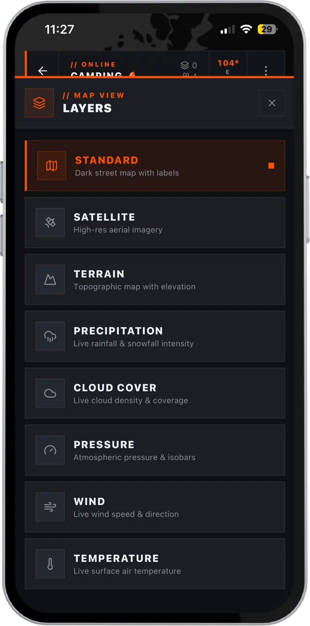
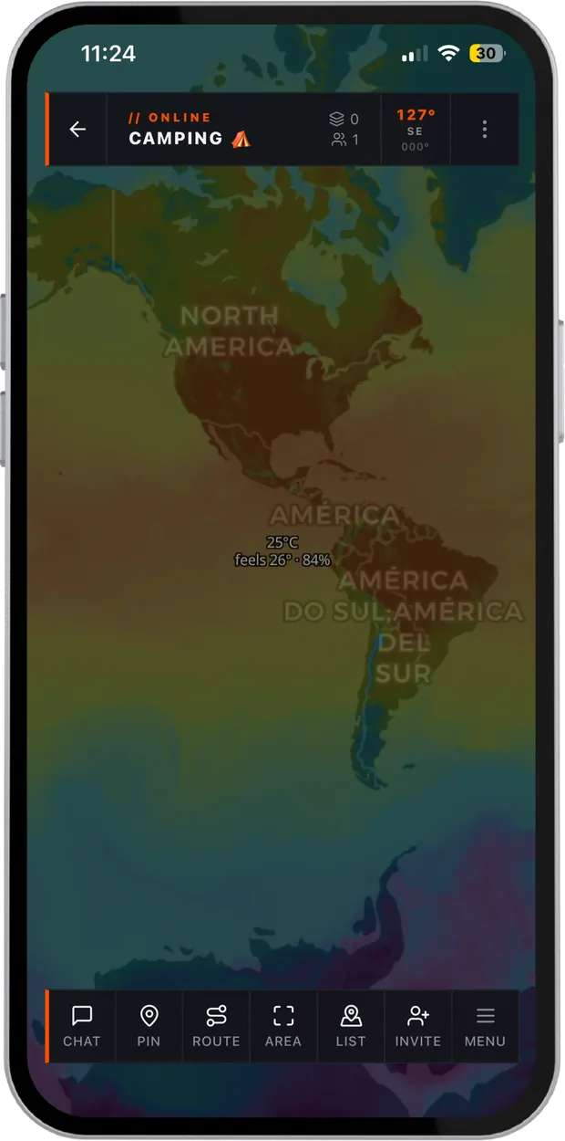
Live weather layered over your group's map, so you can see the storm and the people in its path in one view. No switching apps, no guessing which valley the rain is in.
- Three base mapsStandard, satellite and terrain.
- Five weather layersPrecipitation, cloud, pressure, wind and temperature, on FLARE PRO.
- Cached mapsThe map you have viewed stays on your phone and keeps working offline.
Phone, tablet, browser. One account.
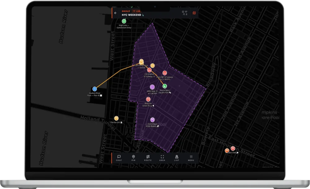
Run the operation from a laptop at base while the team carries phones in the field. Same groups, same map, same chat, always in sync. macOS, Windows, Linux and any browser, nothing to install for the web.
- Big-screen coordinationSee every member, pin and zone at once.
- Native desktop appsmacOS, Windows and Linux.
- Web appOpen it in any browser and sign in.
No signal? Still together.
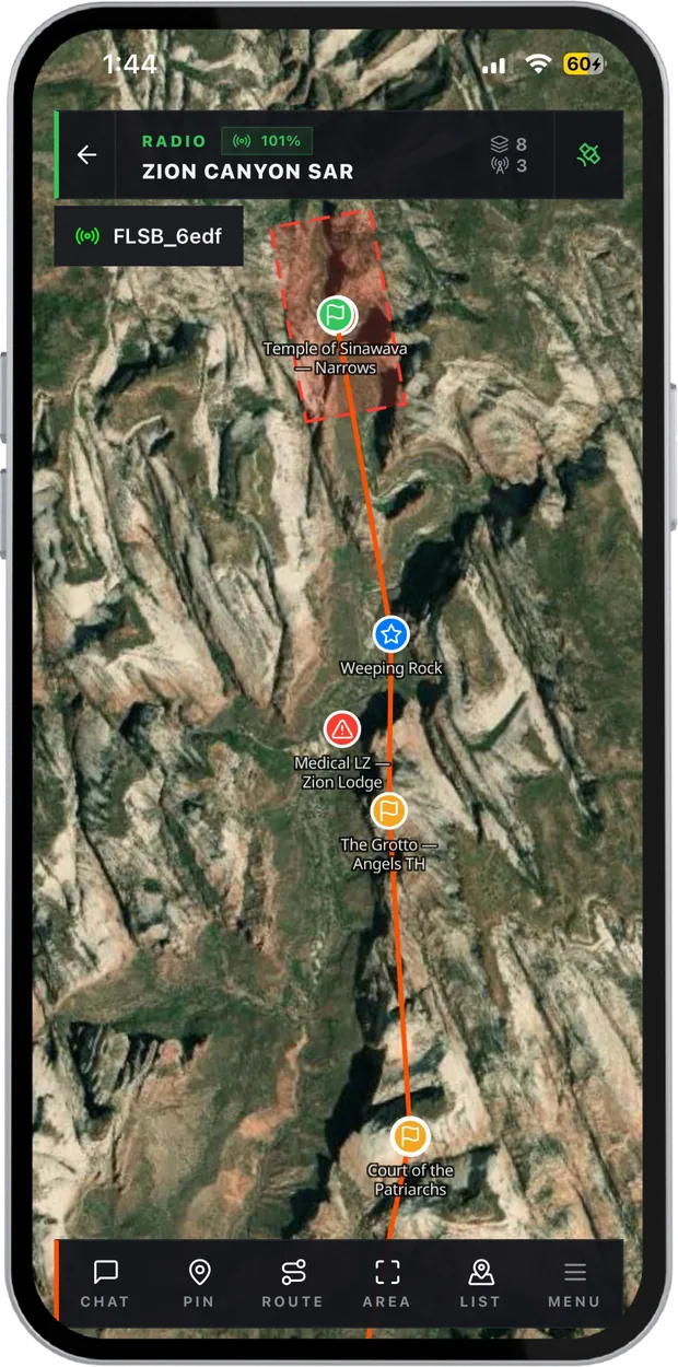
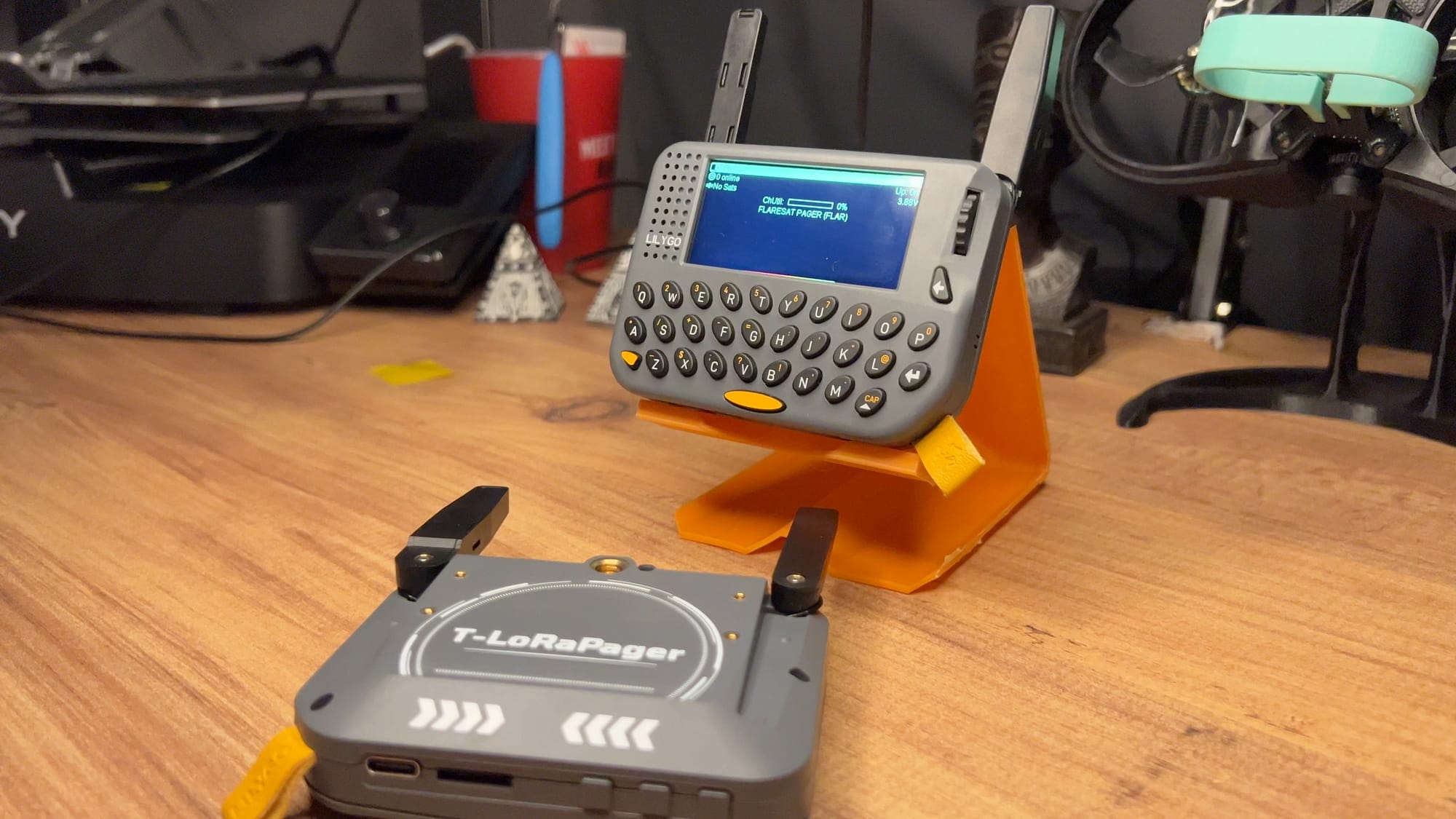
Pair a small LoRa radio and the group keeps its map, chat and pins with no towers, SIM or data plan.
Works when the internet doesn't.
Pair Maps with a LoRa radio and the group keeps tracking and talking with no cell service at all. No towers, no SIM, no subscription. When anyone gets signal again, everything syncs.
- Pair over BluetoothEach person carries a small LoRa radio paired to the app.
- Same map, no towersLocations, pins and messages go radio to radio, kilometres apart.
- Syncs when you're backThe moment anyone has signal, the group's map catches up.
Self-healing mesh
Messages hop radio to radio. If one drops out, the network routes around it.Live radio tracking
Every member's position, sent over the mesh and drawn live on the map.Encrypted channels
Set a passphrase on a channel and only radios with it can read your traffic.Relay Bridge
Link a radio group to an online group. Pins, routes and messages sync both ways.Full radio control
Pair, tune and set encrypted channels from Maps. No separate radio app.No account needed
Go radio-only without signing up for anything.Delivery status
See whether each message is pending, sent or failed.Node tracking
Any node on the mesh, on the map, with its last position.Radios we carry.
The radios our team has paired, flashed and field-tested with Maps. Each one carries the Carroted Maps Ready badge.
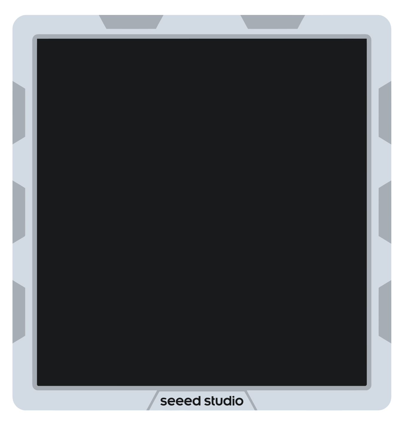
SenseCAP Solar Node P1 Pro
- Range
- 20 km
- Battery
- 9+ days · solar
- Weight
- ~320 g
- Rating
- IPX5
5 W solar panel · 13,400 mAh · SMA antenna · Grove I²C
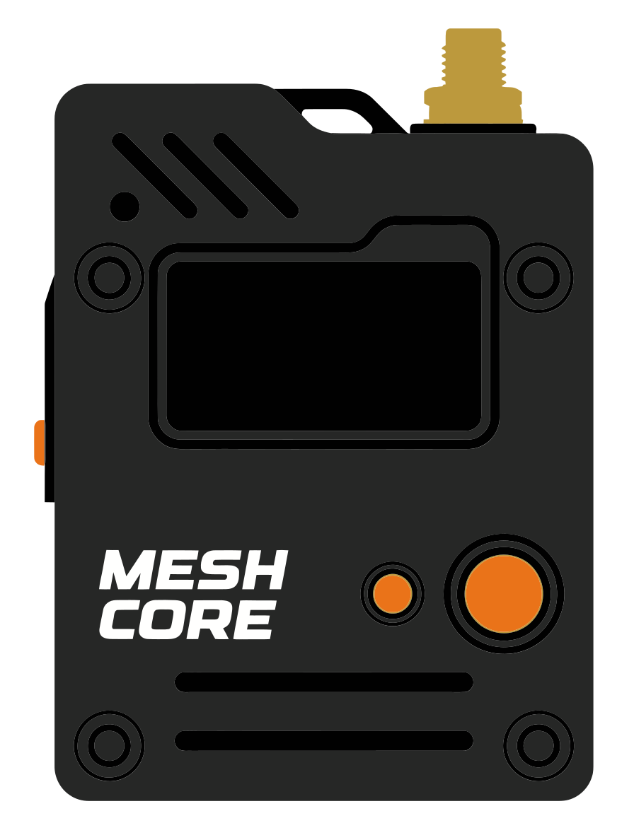
Wio Tracker L1 Pro
- Range
- 10 km
- Battery
- 2 to 3 days
- Weight
- ~85 g
- Price
- $43
1.3" OLED · Joystick · 2,000 mAh · Grove
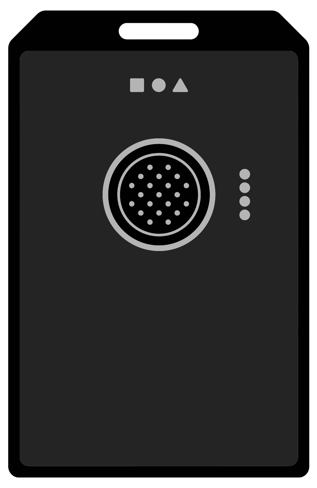
WisMesh Tag
- Range
- 10 km
- Battery
- 5 to 6 days
- Weight
- ~38 g
- Rating
- IP66
Accelerometer · 1,000 mAh · LED indicators



What's inside.
Every feature in the app, grouped the way the app groups them. All of them are free unless the pricing below says otherwise.
Mapping toolkit
Mark the world and share it with the group as you go.
Drop pins
Name, describe, place by tap or coordinates.Draw routes
Trace any path with a finger.Mark areas
Shade zones, grids and sectors.Compass and heading
A live bearing display.Geofence alerts
Enter and exit notifications.Weather overlays
Rain, wind, temperature, pressure.One-tap navigate
Hand off to Apple Maps or Google Maps.Photos and voice notes
Attach them to any pin, route or area.Item comments
Discuss any pin, route or area.Place search
Jump to any city, address or landmark.Team coordination
Everyone live, the conversation in context, many groups without the chaos.
Live tracking
Every member, in real time.Map chat
Talk without leaving the map.Voice notes
Send audio to the group.Chat photos
Share pictures in the group chat.Organizations
Nested groups, three roles.Live Share
Broadcast for up to 8 hours.QR invites
Scan to join, guests need no account.Two kinds of group
Online groups for town, mesh channels for the hills.One account everywhere
Phone, tablet, desktop and web, in sync.Cloud backups
Every map and history, backed up.Radio network
Pair a LoRa radio and the whole group stays on one map with no cell service.
LoRa mesh
A self-healing radio network.Offline first
Maps cached, the app keeps working.Relay Bridge
Mesh to online, both ways.AES-128 channels
Passphrase-encrypted.Delivery status
Pending, sent or failed.Node tracking
Any mesh node on the map.No account needed
Go radio-only without signing up.Full device control
Power, repeater mode, GPS, diagnostics.Wherever your group goes.
From a weekend away to a search across a mountain: the same map, set up the way the job needs it.
Nobody gets left on the trail.
See the whole group stretched along the trail, message the back marker, and do it in valleys where phones have no bars.- A radio each, paired at the trailhead
- Pins for camp, water and the meeting point
- A zone around camp to see who has arrived
Every searcher on one map.
Assign sectors, mark cleared zones and coordinate hand-offs over the mesh, long past the last cell tower. Recorded routes show exactly what was covered.- Sectors drawn as areas, alerts on the edges
- A solar node on high ground to extend the mesh
- Routes recorded for the debrief
Run the site, not the radio chatter.
Stewards, medics and security on one live map when thousands of phones jam the network.- Zones for gates, stages and first aid
- Roles so each team sees what it needs
- Live share links for contractors
Convoy together, camp together.
Keep every vehicle on the map across deserts and mountain passes, with the weather for the road ahead.- A roof-mounted radio per vehicle
- Weather layers for the days ahead
- Relay Bridge to reach home from any signal
Know every patrol, every round.
Live positions, incident pins and recorded routes, on sites with basements, yards and dead zones.- The perimeter and restricted areas drawn once
- Alert zones on the places rounds must not skip
- Routes reviewed each morning
Coordinate in silence.
Mark blinds, sightings and safety lines, and message the group over the mesh without a sound, deep in the woods with no reception.- Pins for blinds and sightings
- Areas for safety lines
- Text over radio, no calls
Live in 30 seconds.
No IT setup. No training manual. Create a group, share the link, and your team is on the map.
Create a group
Tap +, name it and pick a colour. The shared map is ready in under 30 seconds, with nothing to configure.Invite your people
Share a link or a QR code. Anyone on iPhone, Android or a browser joins at once, and guests need no account.Coordinate live
Everyone moves on the map. Drop pins, draw routes, chat in context, and pair radios when you head off-grid.Free to start. One plan for more.
Groups, chat, live location, and every off-grid radio & mesh feature are free forever. FLARE PRO adds more room for teams that need it.
Free
$0forever- Groups, chat and live location
- Pins, routes, areas and alert zones
- Every off-grid radio and mesh feature
- iPhone, iPad, Android, desktop and web
FLARE PRO
$7.99/ month · $59.99 / year- Weather map layers
- Unlimited groups
- Unlimited map items
- 50 alert zones
- Unlimited photos per item
- Unlimited voice notes
Straight answers.
01Is Carroted Maps free?
02Do I need a radio to use Maps?
03How does it work without signal?
04How far does the radio reach?
05Which radios work with Maps?
06Is my location private?
07Can guests join without an account?
08Which devices does it run on?
We read every message.
Have a question, a feature idea, or want to show us how you used Maps? Reach out, we'd love to hear from you.
Your group, on the map.
Free. No credit card. Your first group is live in under a minute.